We provide a wide range of surveying and drafting services, including Aerial Surveying and Imaging, Construction Layout, Topographical Surveys, Control Surveys and 3D Laser Scanning (see our Geomatics page).
With over 8 years of experience in the Geomatics Industry we can provide you with highly accurate and reliable data for all of your surveying and drafting projects.
We are based just outside of North Bay, Ontario. We can provide surveying services anywhere in Ontario. Whether it is a remote fly in location in Northern Ontario or in downtown Toronto, we would be happy to be a part of your project.
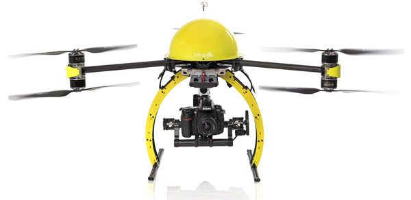
We offer a range of aerial surveying and imaging solutions, using an Infinite Jib™ Surveyor 630 Unmanned Aerial Vehicle (UAV). The Infinite Jib™ Surveyor 630 is a robust Multirotor UAV. It is able to fly in a variety of weather conditions, carrying an array of sensors or cameras. Our technology is quick, safe, and accurate.
 (more…)
Geomatics is defined as the modern discipline which integrates the tasks of gathering, storing, processing, modeling, analyzing, and delivering spatially referenced or location information. It encompasses the disciplines of surveying, hydrography, mapping, remote sensing (often called earth observation) and geographic information processing, often called geographic information systems (or GIS).
Using advanced GNSS/GPS Surveying Systems, Robotic Total Stations and Laser Scanners, we can provide the solutions you need to help your project succeed.

(more…)


